N
Geographical Information
Systems Training Conducted
for the Town of Stoneville
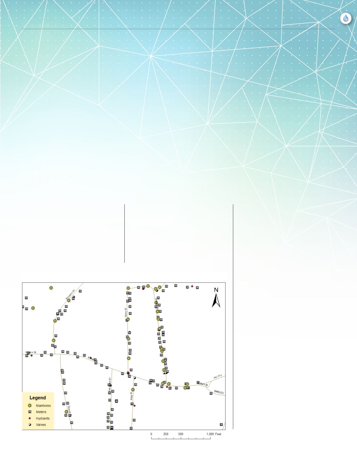
TOWN OF STONEVILLE WATER & SEWER
Fall 2014
3
feature
By Brian Grogan
CRWA recently completed a GIS training
program for the Town of Stoneville. The
Town of Stoneville, like many other utilities
around the state, wanted to update their
mapping system to a more versatile digital
system. Rural Water staff provided hands
on training in the use of a Trimble Geo XH
6000 GPS. Training included data collection,
differential correction and exporting of files
to a geodatabase in ESRI ArcMap. During the
course of the project, over 1,150 features were
mapped using the Geo XH GPS, including
manholes, water meters, hydrants and valves.
The end result is a digital map and associated
database with information on each feature.
The Town of Stoneville decided to
partner with NCRWA on our GPS
mapping project because of the
outstanding experiences we have had
working with their staff in the past. We
wanted to build internal capacity for
collecting GPS data as well as create
interactive maps to make our personnel
more effective in the field. This allowed
us to become fully compliant with
DENR requirements as well as track
maintenance, repair and replacement
information for all of our water and
sewer infrastructure in Town. The total
cost of the program was far less than
purchasing our own GPS equipment
and RWA staff made themselves
available before, during and after the
project to ensure project success as
well as customer satisfaction.
– Ken Gamble, Town Administrator
If you are interested in NCRWA’s GIS training program,
contact Brian Grogan at (336) 309-6529 or
for more information.


